You are here: Applications » Highway construction
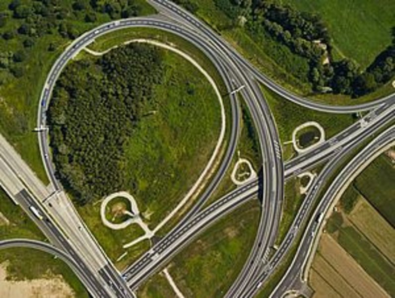
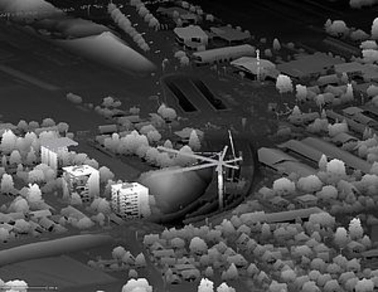
Combined laser scanning and mapping was done during the reconstruction of the Highway interchange at Graz-East and the construction of the connecting segment B67a - Liebenauer Gürtel.
The data can be used to document the progress and the mass movement of excavation.